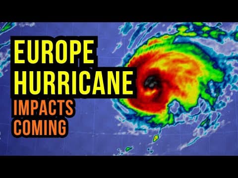
Hurricane Gabrielle is set to impact Europe, particularly the Azores, Portugal, and Spain. With hurricane warnings in effect, residents are urged to prepare for strong winds and heavy rainfall. The storm will transition into a subtropical system as it moves across the Atlantic, bringing potential tropical storm conditions to mainland Europe. This post details the expected path, wind speeds, and rainfall estimates, as well as safety measures for affected areas.
Hurricane Gabrielle is on a trajectory that will bring significant impacts to Europe, particularly the Azores, Portugal, and Spain. Meteorologist Brian Shields provides an in-depth analysis of the storm's path, expected conditions, and necessary preparations for residents in affected areas.
As of September 24, 2025, Hurricane Gabrielle is moving east of Bermuda and is expected to maintain its strength as it approaches the Azores. It is not uncommon for remnants of tropical systems to reach Europe, with about two to five systems impacting the region each year. However, Gabrielle is anticipated to be more potent than usual.
The Azores are currently under hurricane warnings, with preparations underway to protect life and property. The entire archipelago is expected to experience hurricane conditions, with winds gusting up to 110 km/h (70 mph). Residents are advised to be in their safe locations by early tomorrow afternoon as the storm approaches.
Gabrielle is projected to reach the Azores by tomorrow night, with hurricane conditions beginning to affect the western islands around 6 to 8 PM. The storm is a fast mover, meaning it will pass through the islands quickly, but the impacts will vary depending on the specific island's location.
After impacting the Azores, Gabrielle will continue its path toward mainland Portugal and northern Spain. By Saturday morning, the storm will bring increasing seas and rainbands to these areas, with tropical storm conditions expected along the coast.
The forecast indicates sustained winds of 70 mph (110 km/h) for the Azores, with hurricane conditions expected overnight. As the storm moves toward the Iberian Peninsula, wind speeds will decrease but still pose a risk, particularly along the coast of Portugal and Spain.
Rainfall is also a significant concern, with estimates suggesting that some areas could receive up to 150 mm (approximately 6 inches) of rain. This could lead to flooding, especially in regions that are already saturated or have experienced recent heavy rainfall.
Residents in the Azores and along the Iberian Peninsula should take the following precautions:
As Gabrielle progresses, meteorologists will continue to monitor its path and potential changes. While the current models show consistency in the storm's trajectory, any slight shifts could alter the expected impacts.
In addition to Gabrielle, other weather systems are expected to bring rain to parts of France, Italy, and Greece over the weekend. This could provide much-needed moisture to areas experiencing drought conditions.
Hurricane Gabrielle is a significant weather event that requires attention and preparedness from residents in the affected areas. With hurricane warnings in place and the potential for tropical storm conditions across mainland Europe, it is crucial to stay informed and take necessary precautions. As the hurricane season continues through November, vigilance will be key in ensuring safety during these unpredictable weather patterns.