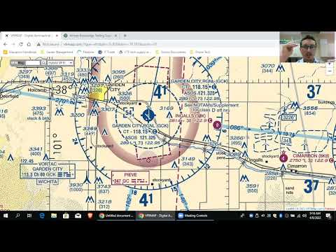
This blog post provides a comprehensive guide on how to read sectional charts for the FAA Part 107 exam, focusing on obstructions like towers, airspace classifications, and compass readings. It explains how to interpret airspace floors and ceilings, measure distances, and understand the significance of various symbols and numbers on the charts.
In preparation for the FAA Part 107 exam, understanding how to read sectional charts is crucial. This guide will cover the interpretation of obstructions such as towers, the classification of airspace, and how to use compass readings effectively.
Sectional charts are essential tools for drone pilots, providing vital information about airspace and obstructions. Let's break down the key components.
When examining sectional charts, obstructions like towers are represented with specific symbols and numbers. For instance, the Norfolk International Airport is a good example to illustrate how to read these charts.
Understanding the floors and ceilings of airspace is vital for safe drone operation. For example:
It's important to note that different airspaces can overlap. For example, the Norfolk area has both Class Charlie and Class Delta airspace. The dashed blue line indicates Class Delta airspace, which is effective below 2,000 feet. If you are flying at 2,000 feet, you are in Class Charlie airspace, not Delta.
When questions arise regarding distances from obstructions, sectional charts provide a scale for measurement. The scale includes nautical miles, statute miles, and kilometers. For example, if a question states that an obstruction is five statute miles southeast of an airport, you can use the scale on the chart to measure the distance accurately.
Consider a scenario where you need to inspect a tower located five statute miles from the Elizabeth City Airport. By using the scale, you can determine the approximate location of the obstruction and assess the airspace classification in that area.
When analyzing towers on sectional charts, two key numbers are provided:
If you want to fly your drone to the maximum altitude above a tower, you can add 400 feet to the height of the tower. For instance, if the tower is 262 feet tall, you can fly up to 662 feet (262 + 400) as long as you remain within 400 feet of the tower.
Understanding compass readings on sectional charts is also essential. A blue solid circle around an airport may appear to indicate airspace, but it actually represents a compass. The numbers around the compass indicate directions:
These numbers are simplified to save space, dropping the zero from the full degree (e.g., 90 becomes 9).
Navigating sectional charts for the FAA Part 107 exam requires a solid understanding of airspace classifications, tower heights, and compass readings. By mastering these concepts, you will be better prepared to answer questions related to drone operations and airspace regulations. If you have any questions or need further clarification, feel free to leave comments for additional assistance.